


April 17 More Clouds And Cooler With A Return Of Rain And Thunderstorms
Wednesday, April 17 Morning Report The warm weather we have had continues to step backwards. After 80s on Monday and 70s yesterday, today many in our region can expect the…
November 23 2021
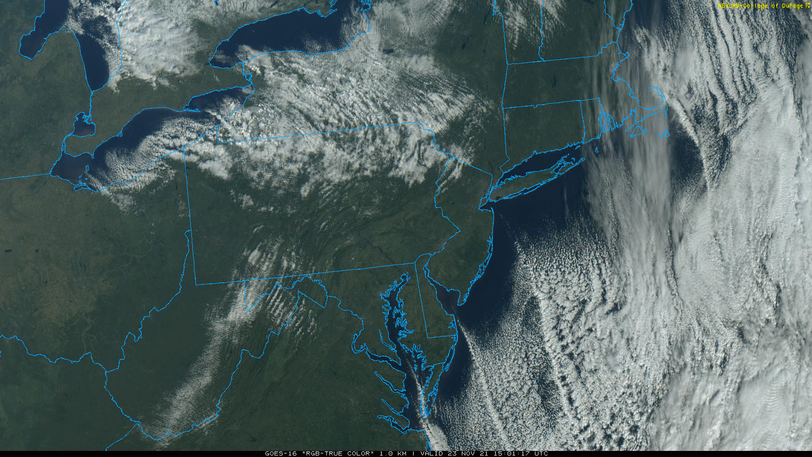
One sign of the season is cold air flowing over warm water producing clouds. We often talk about the major impact of Lake Effect snow across the Great Lakes. This is a common occurrence with heavy snow falling downwind into Michigan, Ohio, Pennsylvania, and New York State.
The Great Lakes are large and conducive to this.
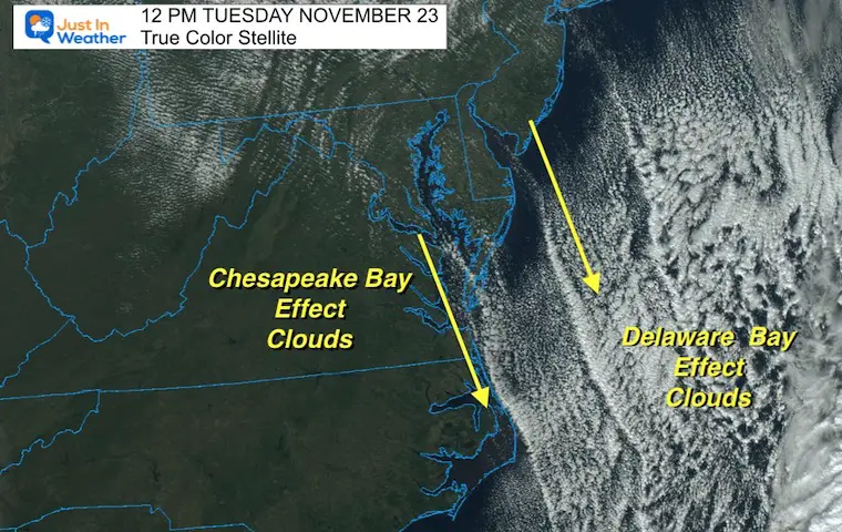
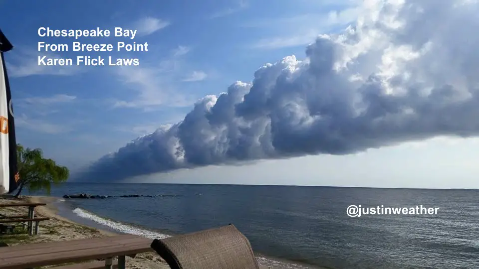
The Chesapeake Bay is also a large body of water, but it is less common to get this effect because the condition have to be just right.
The Bay is long and narrow, with an orientation almost due north to south. So the wind must flow over that stretch to get a fetch more than 100 miles to develop a similar result.
Today we had that, also on the Delaware Bay.
The band of long narrow clouds, or streamers, can be seen in the southern part of the Bays. This is where the conditions were just right and allowed the moisture to build of, converge, and condense as it flowed out into the ocean. Any flurries or sprinkles were for the fish and boaters.
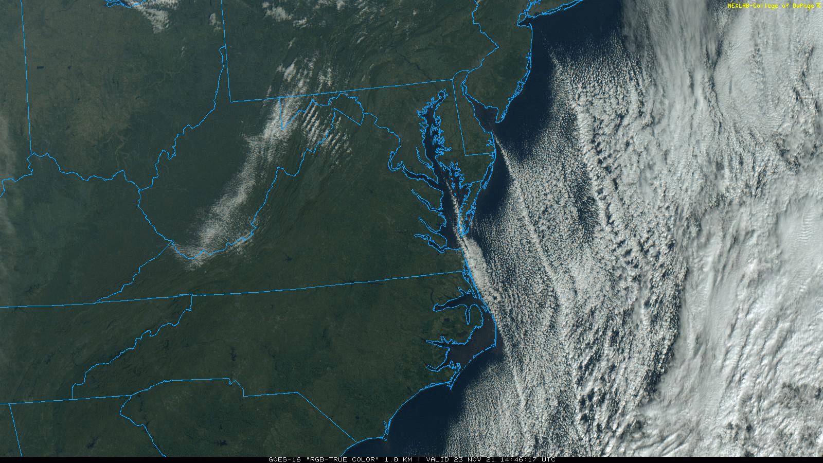
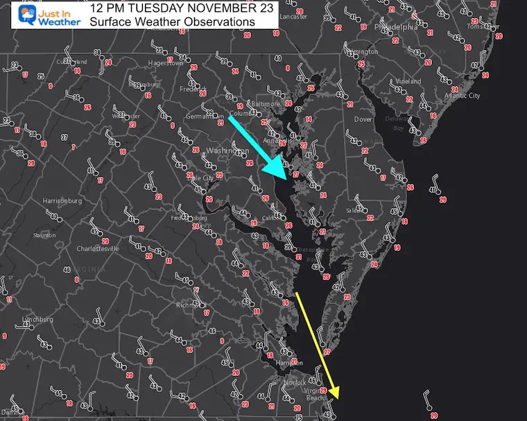
This morning the air temperatures were in the 30s to lower 40s. The water temperature was in the 50s.
The wind flow was North-Northwest, with a more north 340º wind in the southern part of the Bay. This allows the plume to develop and flow out into the ocean.
The resulting cloud formation was in the lower part of both bays and extending out into the Atlantic Ocean. These ‘streamers’ can be seen orienting with the wind flow.
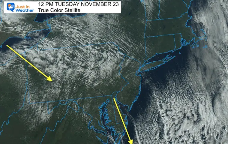
There is a wider fetch of water and more widespread clouds… This region did get snow squalls last night and this morning.
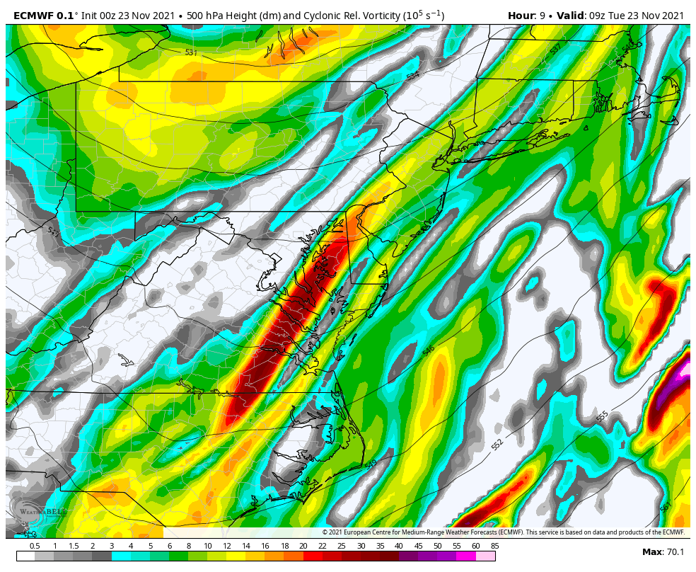
Clouds are shifting south with the upper level distance or Vort Max I mentioned in my morning report.
This was in July 2015


Last Winter Recap: My Old Outlook And Your Grades Of My Storm Forecasts


