


Average Last Frost or Freeze Dates And Map For Maryland
There is a good reason why many gardeners suggest NOT to plan tomatoes until after Mother’s Day. Early surges of warm air in spring can be deceiving. Just because the…
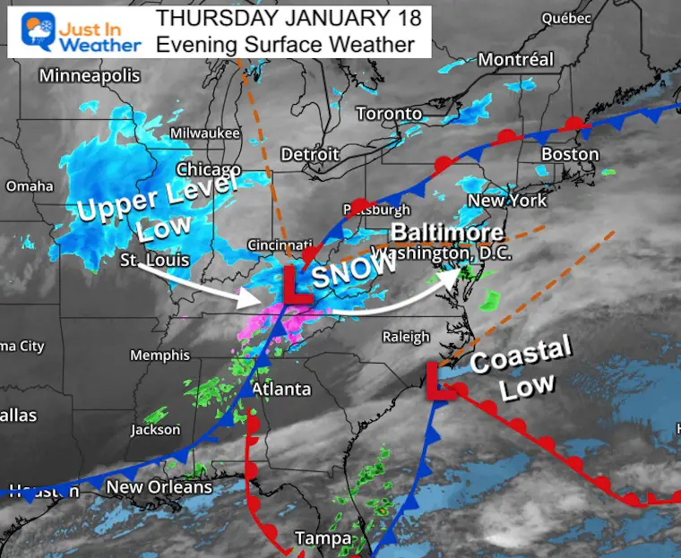
Thursday Night January 18 2024
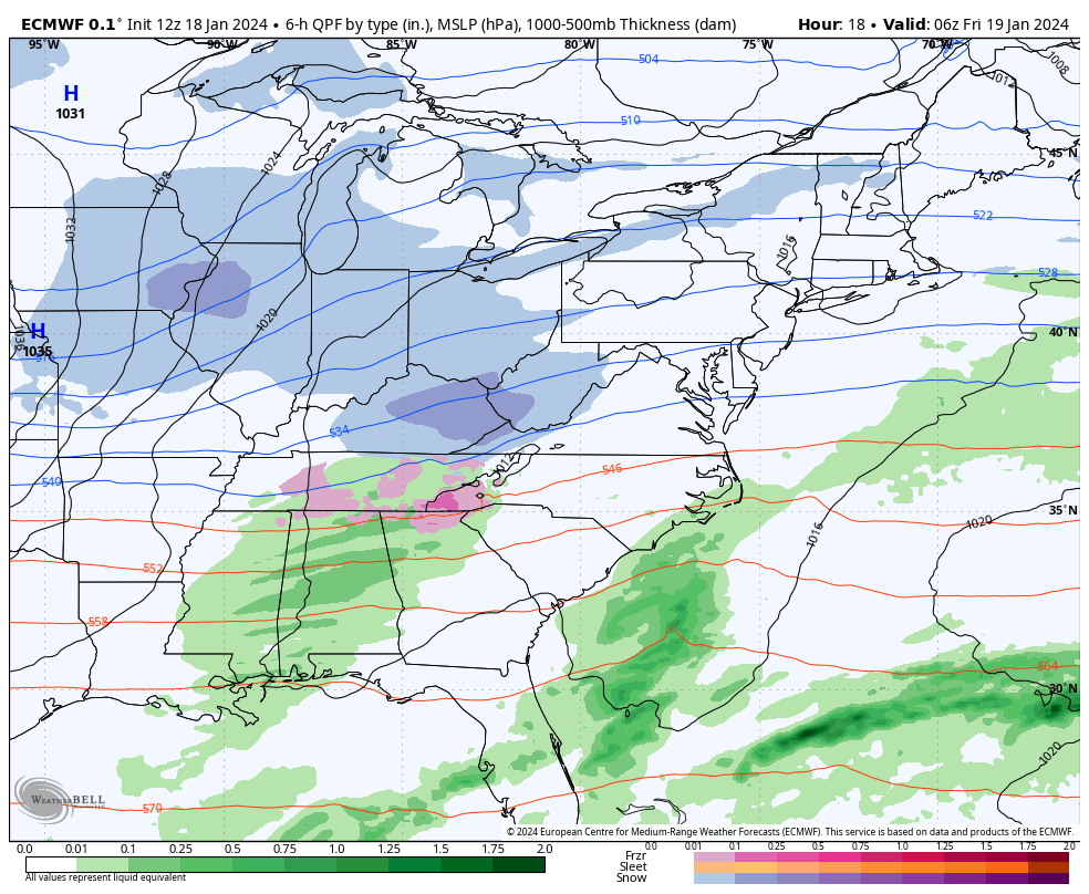
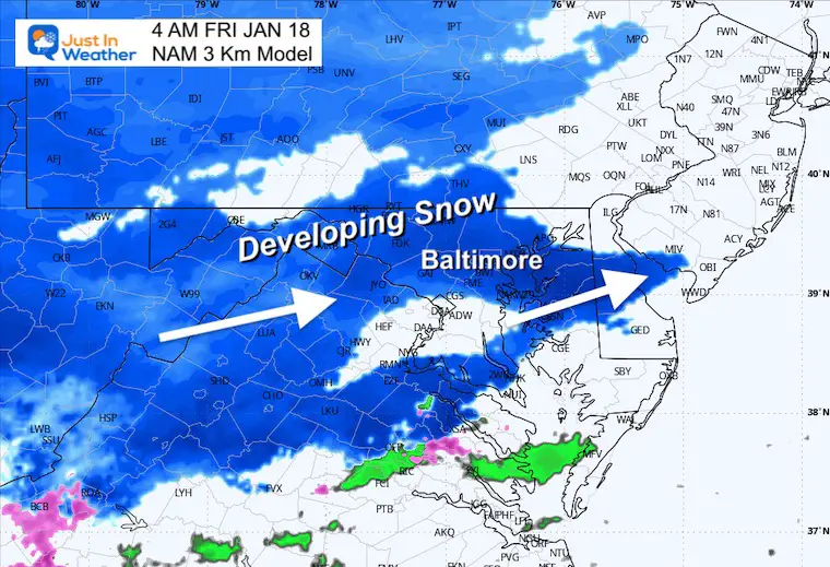
We have already seen a burst of snow showers this evening, which tells me that the atmosphere is primed for more moisture. That means we should not have to worry about Virga (false returns) on radar. It also suggests that the snow may begin sooner… very early Friday morning.
In my last few reports, I mentioned the chance for a Meso-Low to develop near the coast. This is a more local circulation that can enhance and extend the duration of snowfall.
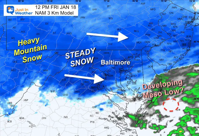
While the original Low will be far off the coast, it looks like the local enhancement between noon and 4 PM may increase the moderate snow somewhere between Baltimore and Philadelphia.
The National Weather Service has upgraded to a Winter Storm Warning for metro Philadelphia based on this logic and snowfall in the range of 4 to 6 inches. Looking at some of the modeling and even the NWS maps suggests the qualifying numbers for a warning may get expanded.
I want to do something different. If you just want the main snow maps, I will show them. The forecast details and model maps are below.
I increased my expectations based on the atmosphere set up for snow to begin earlier, last longer, and get some enhancement from that Meso-Low I will show you below.
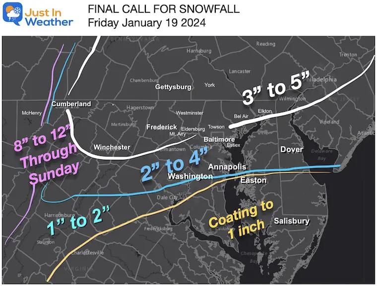
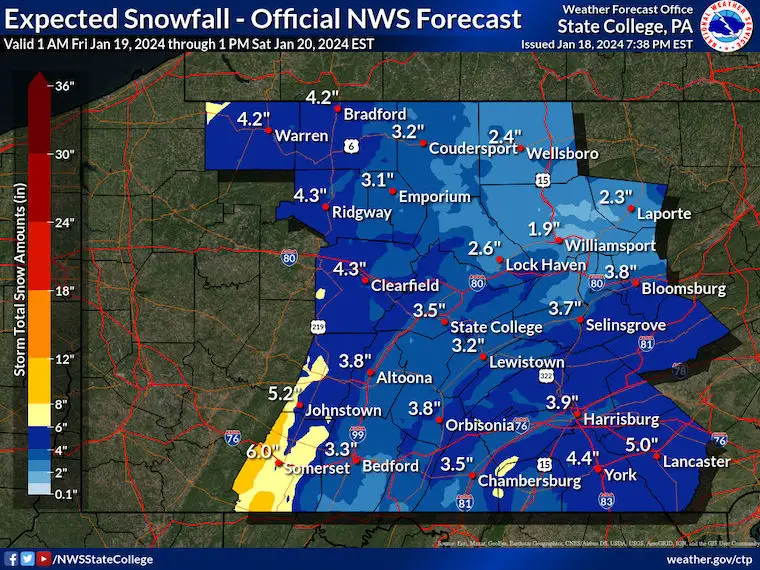
The Warning for metro Philadelphia is for around 5 inches of snow, but we can see similar numbers in Harford and Cecil Counties in Maryland.
I DO NOT ISSUE THE WARNINGS. Only the NWS has that authority, and it is worth watching to see if the Sterling, VA office will make the same move.
The other Warning is for 8 to 12 inches in the mountains of Western Maryland and West Virginia.
Winter Weather Advisory covers most of Maryland.
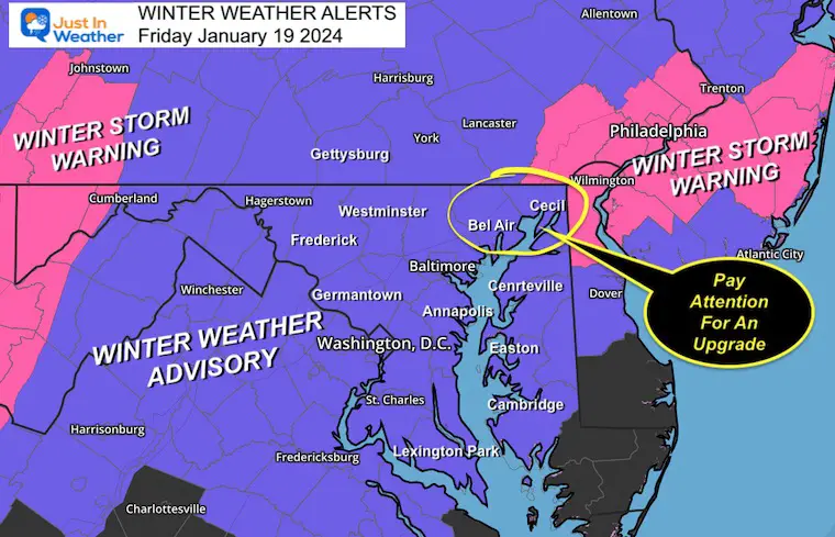
NWS Sterling forecast region.
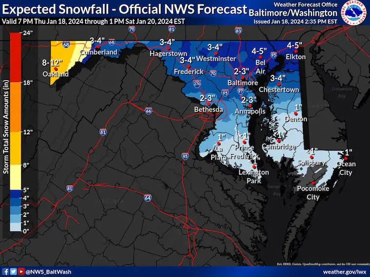
They are showing between 4 and 5 inches for Harford and Cecil Counties.
This shows the increase across Washington and Annapolis as well into the 2 to 3-inch range.
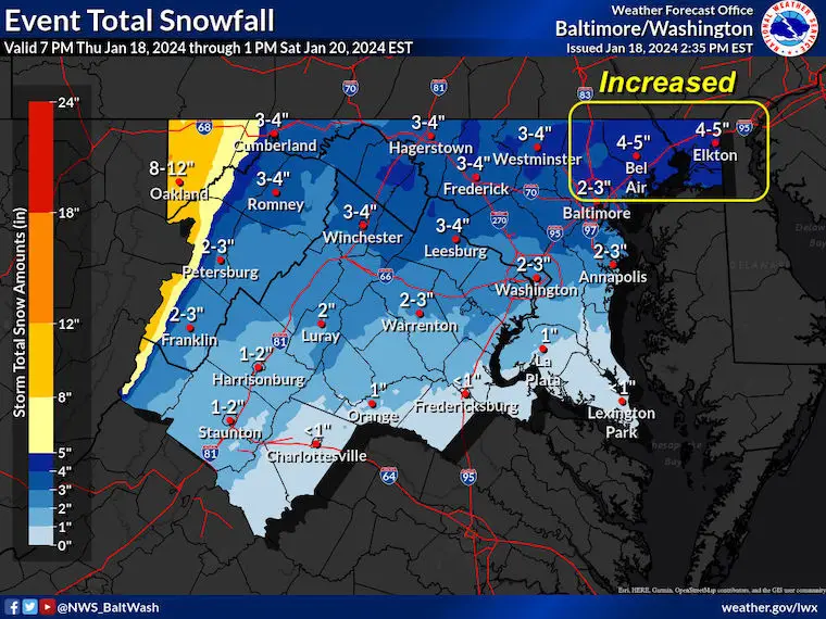
Increase to 4 to 5 inches across Adams, York, and Lancaster Counties.
The Surface Low along the North Carolina coast was expected to be the main player. I am seeing more activity with the Low in Kentucky, and this may be a driving force for the enhanced snow on Friday.
The cyclonic spin and fast wind are what may help enhance the developing Meso-Low.
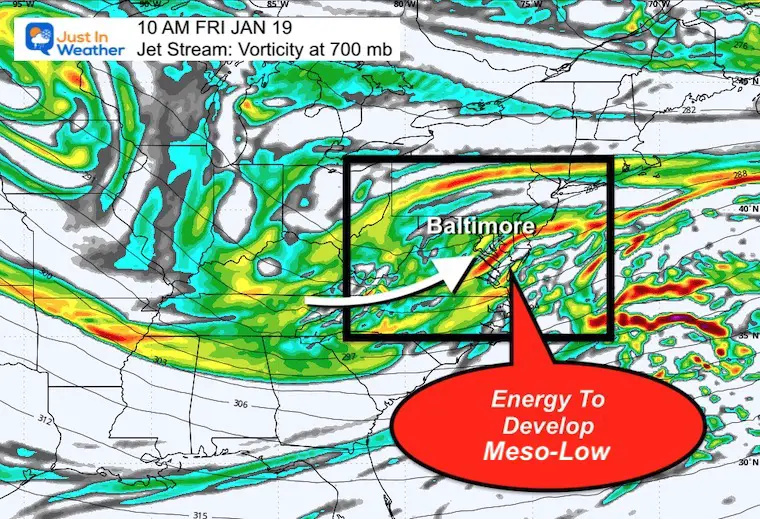
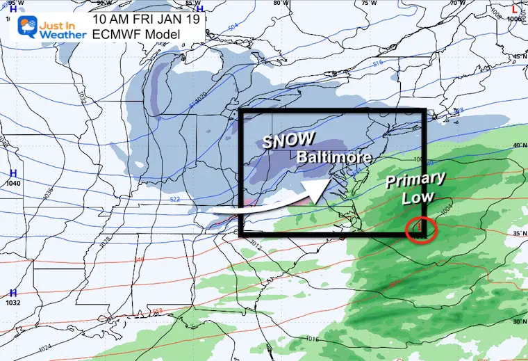
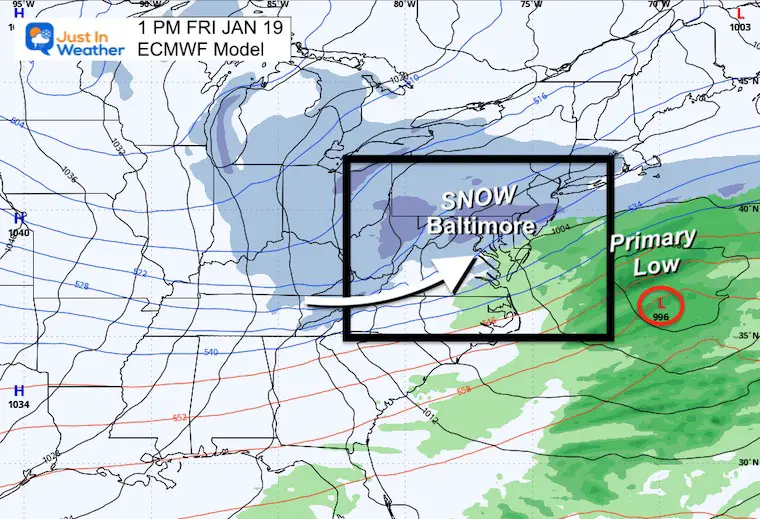
This is when we may have the new Low near the coast to enhance the snow for a few more hours.
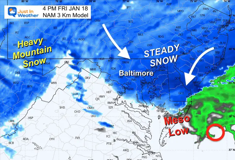
The atmosphere is primed to pump a little more snow. Moderate snow in the darker blue. We can see the enhancement with the Meso-Low along the coast in the afternoon.
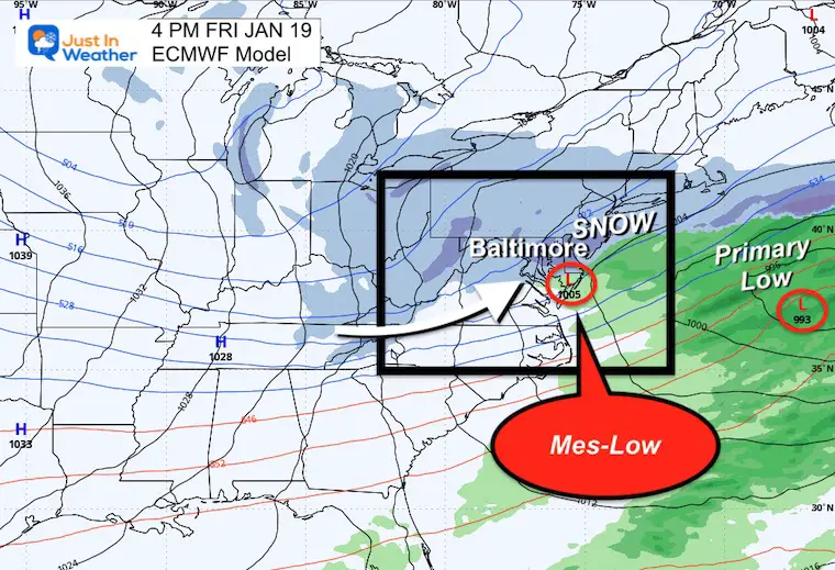
This is the Meso-Low and expanded banding of Moderate Snow. We will compare it to the High-Resolution NAM 3 Km Model below that has this West over central Maryland.

I am seeing the snow expand into metro areas between 3 and 5 AM, then remain steady most of the day. The expanding snow for the afternoon is a reflection of that Meso-Low. See snapshots below.
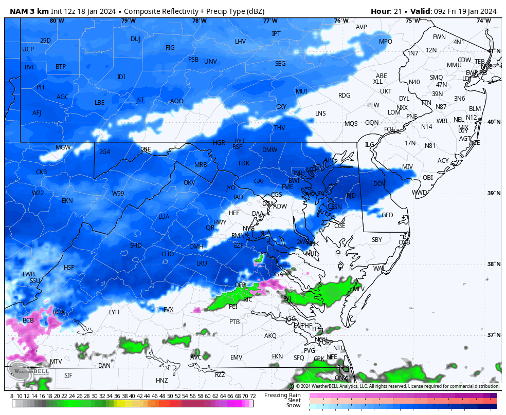
Steady snow is in place for sunrise and whoever needs to commute. It will be slick!
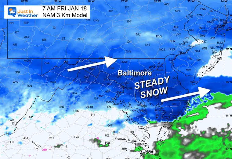
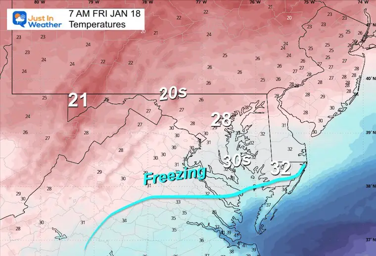
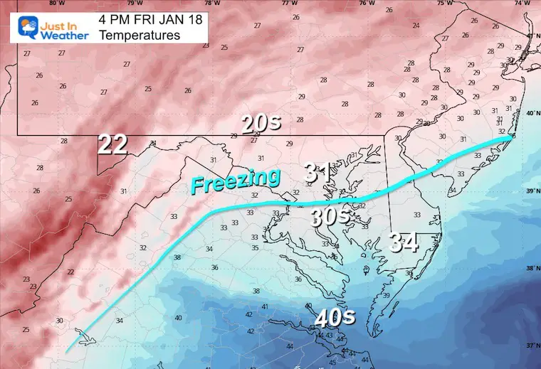
Most will be below freezing, which will maximize the stickage.
Steady snow should continue to fall…
If that Meso-Low takes form, it will be developing around this time. This location is closer to Ocean City.
If that Meso-Low forms, it may be nearly stationary. That would mean enhancing snow but remaining in nearly the same locations for a few hours.
The freezing Line may try to get close to Baltimore… but if that Meso-Low Forms, it will pull in colder air from the west and keep this mostly snow… except for Southern Maryland.
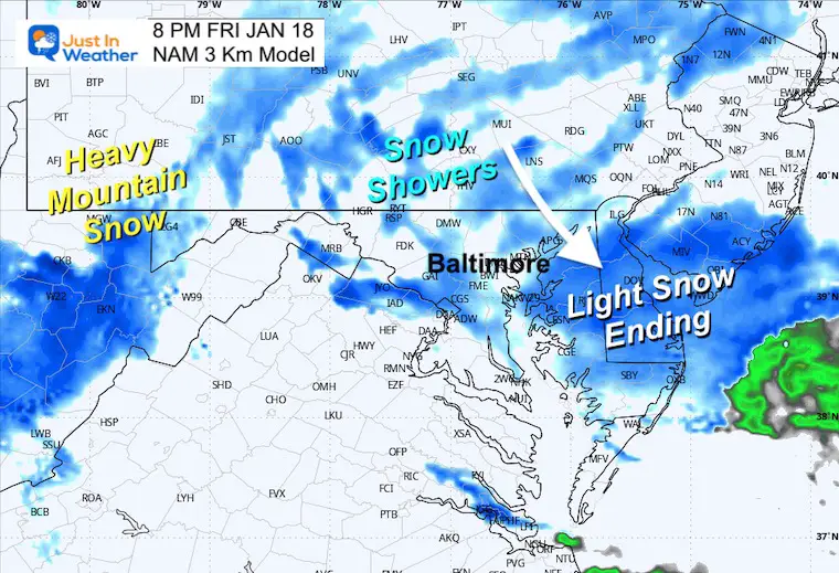
Snow finally tapering off to showers and furries.
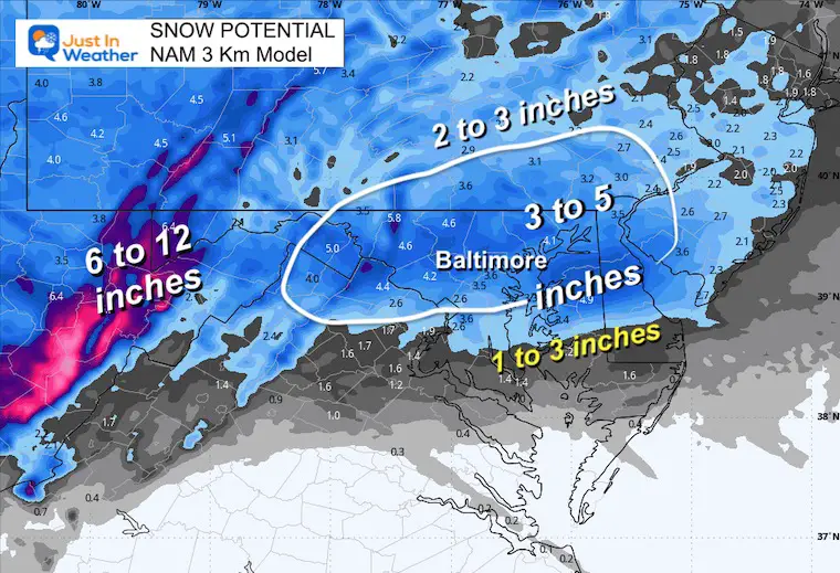
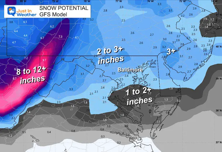
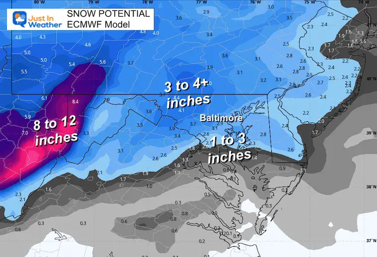
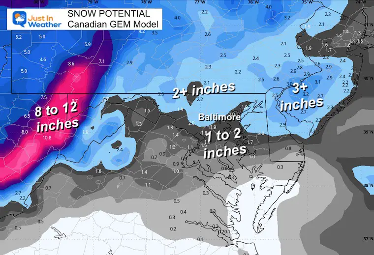
The following models are still showing lower numbers in central areas.
Click here or the map to see: The Snow Report Ending Jan 16


Computer Models Support East Coast Storm Track

The latest NOAA report is confident in a Very Strong event. Possibly HISTORIC! This refers to the temperatures in the Pacific, with impacts on the US Winter Storm Track.

Winter Weather Folklore: Top 20 and more signals from nature for snow.
Winter Outlook 2024 From Two Farmers Almanacs Return to Cold and Snow


Click to see more and ‘Book’ a visit to your school 
I am aware there are some spelling and grammar typos and occasional other glitches. I take responsibility for my mistakes and even the computer glitches I may miss. I have made a few public statements over the years, but if you are new here, you may have missed it: I have dyslexia and found out during my second year at Cornell University. It didn’t stop me from getting my meteorology degree and being the first to get the AMS CBM in the Baltimore/Washington region. One of my professors told me that I had made it that far without knowing and to not let it be a crutch going forward. That was Mark Wysocki, and he was absolutely correct! I do miss my mistakes in my own proofreading. The autocorrect spell check on my computer sometimes does an injustice to make it worse. I also can make mistakes in forecasting. No one is perfect at predicting the future. All of the maps and information are accurate. The ‘wordy’ stuff can get sticky. There has been no editor who can check my work when I need it and have it ready to send out in a newsworthy timeline. Barbara Werner is a member of the web team that helps me maintain this site. She has taken it upon herself to edit typos when she is available. That could be AFTER you read this. I accept this and perhaps proves what you read is really from me… It’s part of my charm. #FITF